![]()
Home
Mission
Overview of Project
Project Staff
Sponsors
Achievements
Checking, Illustrations
Upcoming Activities
Id and Species Lists
Protea Information
Protea Gallery
Growing Proteas
Interim Dist. Maps
Publications
Afrikaanse Inligting
![]()
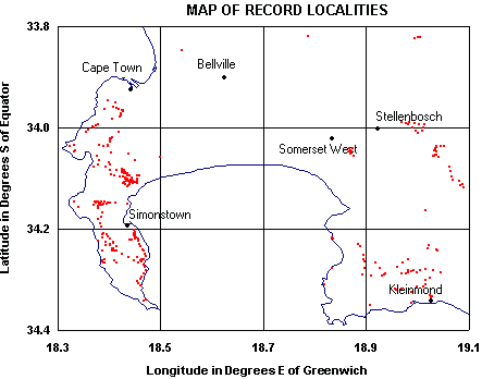
Record Locality Map
The Protea Atlas SRS Database can draw a map (selected by you) of an area that you have atlassed in. The map will show you where your did a Sight Record Sheet(s).
Here is a map of the Cape Penisula and Environs. A red dot shows where a Sight Record Sheet was recorded.
You may also choose what is called a 'Zoom' map, which does just this. All the Sight Record Sheets you did on a certain day, or over a number of days are plotted on a map. This allows you to see the actual route that you walked. The 'Zoom' map is useful in ensuring that you have not made any mistakes when working out the latitude and longitude of your Sight Record Sheet(s).
Here is a Zoom map of a very well known hike in the Cedarberg Mountains that traces out the route Sandrif (Dwarsrivier Farm), Wolfberg Cracks, Wolfberg Arch (yes, I got the Cederberg Pincushion Leucospermum spathulatum), Gabriel Pass, Die Rif and back to Sandrif.
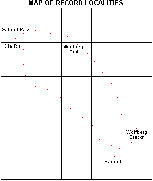
Please note: The place names on the above Zoom map have been put in manually here for clarity. The Zoom map in the Protea Atlas SRS Database does not put in place names.
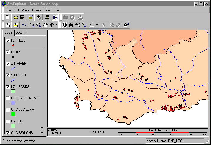
You may choose to use ArcExplorer to display your record localities (SRS's). You can also display where you atlassed a particular protea in the same way as the above maps can. ArcExplorer is a simple to use GIS system but is a little more involved than using the above maps.